Sint Maarten to Grand Turk, Turks and Caicos
Sint Maarten to
Grand Turk, Turks and Caicos
29th
April – 6th May 2015
Approx. 600
miles – no stops
(Author’s note - My memory is a little vague now on this
journey and the log kept is mostly essential information only, which though
helpful is not that interesting to anyone – not even me anymore – so unless
something really exciting was going on this might be dry reading).
Planned
route was Sint Maarten to a waypoint above Anegada, then a long leg supposedly
heading
west with a little bit of north until below Mouchoir Bank before turning further north for Grand Turk
which is just a little bit of land which manages to stay above the reef, or a
7000’ high underwater mountain. It is
the northern part, the southern part of it is about 30 miles south, where the
reef shallows up to about 20feet, quite suddenly.
Off
we went, left with the 10.00am bridge opening to get out of Simpson Bay Lagoon,
all tanks full, Jerry cans full; 200
gallons of liquid and the fridge and cupboards busting open with food. MoondancerX felt like a slug and I knew that
she would sail like one too, until we lightened the load a bit.
This
was the start of our real journey together, the 3 days from St. Lucia to Sint
Maarten just a taster. We settled into
the same 3 hour watch routine where we left off. Our morning routine regardless of who was
trying to sleep – I listened to Chris Parker, the Caribbean weather guru on SSB
radio at 06.30 hrs.
Can’t
really remember now when we started to get news of the potential Hurricane Anna
which was developing to the north of us; think maybe the second morning
out. F--k! So now what to do – plan a duck-out
destination. That was to be Puerto
Plata, Dominican Republic – I didn’t want to go there, bad memories of
Dominican Republic (see 2009 archives).
If we had to stop there it wouldn’t take us too far out of our way. None of us wanted to stop, but the thought of
dealing
with Anna sailing through what is basically a passage between Dominican
Republic,
a
mountainous hunk of land to our south, and a shelf of banks studded with rocks
stretching hundreds of miles just about 90 miles north of us made a compelling
argument to stop.
Sailing
towards Dominican Republic I was struck by the enormity of this land, having lived
and sailed in the Grenadines for the past 3 years, tiny little islands by
comparison. Bodies of water develop reputations
– Mona Passage is one of them, but passing to the north of Mona Passage, even
though we had lots of wind and the seas were rough we were trucking (trucking
for MoondancerX is 5 – 6kts) mostly broad reaching.
Sometimes
decisions get made for you, the wind
decided that we were no longer going to Puerto Plata, it was the right wind to take us to Grand
Turk, or at least generally in that direction.
We had a little conference, all agreed that Anna was now far enough
away, the wind and seas we could handle.
Next destination was a waypoint south of Mouchoir Reef.
Somewhere
around here we had the first inclination that we had a fuel problem, now we really needed confidence in the engine –
coming into reef ridden areas and eventually of course trying to come into
land.
The
primary fuel filter has a clear ‘glass’ bowl underneath the filter which when
we changed the filter was full of black muck.
I know quite a lot about that now as I had to learn what causes it and
how to prevent that and how to get rid of it.
We
changed that fuel filter and now only had 1 new one left and I had the
forboding feeling that this was not the end of this problem. That muck had been sloshing around as we were
rough riding these seas.
Also
somewhere around this time - heading up
towards Mouchoir reef Debra and I had a battle of the I-pad Navionics
charts. Though I do have a paper chart
of the West Indies it is large scale and though good for general passage
planning I really like my GPS chart plotter on my lap top and Navionics on my
I-pad. Debra had downloaded a newer
version of Navionics and hers and
mine
did not agree. And being a couple of
miles out doesn’t matter when you have lots of room but it sure did now. (We found later that her download was not
complete. She completed it in Grand Turk
and then all was well).
This
created quite a bit of friction, not to mention outright fear for me. So we started to plot our lat and long
positions on the chart again. These
positions I trusted as they were coming from 2 other tried and true units which
are fixtures aboard MoondancerX.
The
most memorable watch I experienced was sailing over salt cay reef – the shallowest
point – and watching my depth gauge (engine on ready for quick abort) go from
the maximum reading I have it set at of 400 odd meters to 30, I almost screamed, but held my breath and my
faith that my instruments and all of the GPS’s on board were right, then I
watched without taking another breath as it dropped to 8 meters – I was praying
now, and then as we went over the reef and the depth increased the seas also
laid down. It was an underwater
breakwater.
Maybe Adam heard my strangled scream because
he came up, and now we could turn north towards Grand Turk. As the seas seemed to be a bit flatter we
thought it safe to harden up the sails and speed up.
Wellll,
we did that and were suddenly screaming along a 6 ½ kts, laughing because we
were having soooo much fun – then wham took a wave right over us which went
right down through the companionway, everything that was not held down went
flying, some all over Debra who was sleeping. She was actually covered with
Pringles. My laptop which I had secured with a bungy
broke its way out and was hanging just above the floor and soaked – with salt
water, not good for electronics.
Obviously we were not laughing anymore, went back to our more sedate
speed by reefing down again heading in the right direction.
The
next 20 odd miles to get in and anchored in Turks and Caicos were brutal. We had land in sight, very strong wind and
current holding us off, new problem with
our transmission which we thought was the linkage, another with our autohelm
and then the dreaded Fuel. We tried to sail in for the first couple of
hours but made no progress, in fact were just sailing away, so we gave up on
that. Adam disconnected the gear linkage
and engaged the transmission at the linkage by-passing the cable from the
levers and Debra steered us in through very strong wind and current
while
the autohelm self-engaged when not wanted but wouldn’t hold when it was.
We
were doing about 2 – 3 kts. It took us 6
hours to go 16 miles.
Coming
up to our anchorage the depth was still 7000 feet deep about a quarter of a mile
offshore, and then 10ft, YIKES. That was ok though, we were in, manoeuvring
around coral heads until we found a nice sandy spot where we dropped the hook.
All
of us were exhausted, tired, stinky but happy – and just about to be ripped off
by the so-called helpful Citizen who took us for a ride.
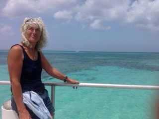
That smudge off in the distance is MoondancerX, that's how far from shore we had to anchor.


Comments